Morgan Walter · 8 October 2026
Charting Sediment Shifts in Remote Estuaries With Tailored Imaging Gear
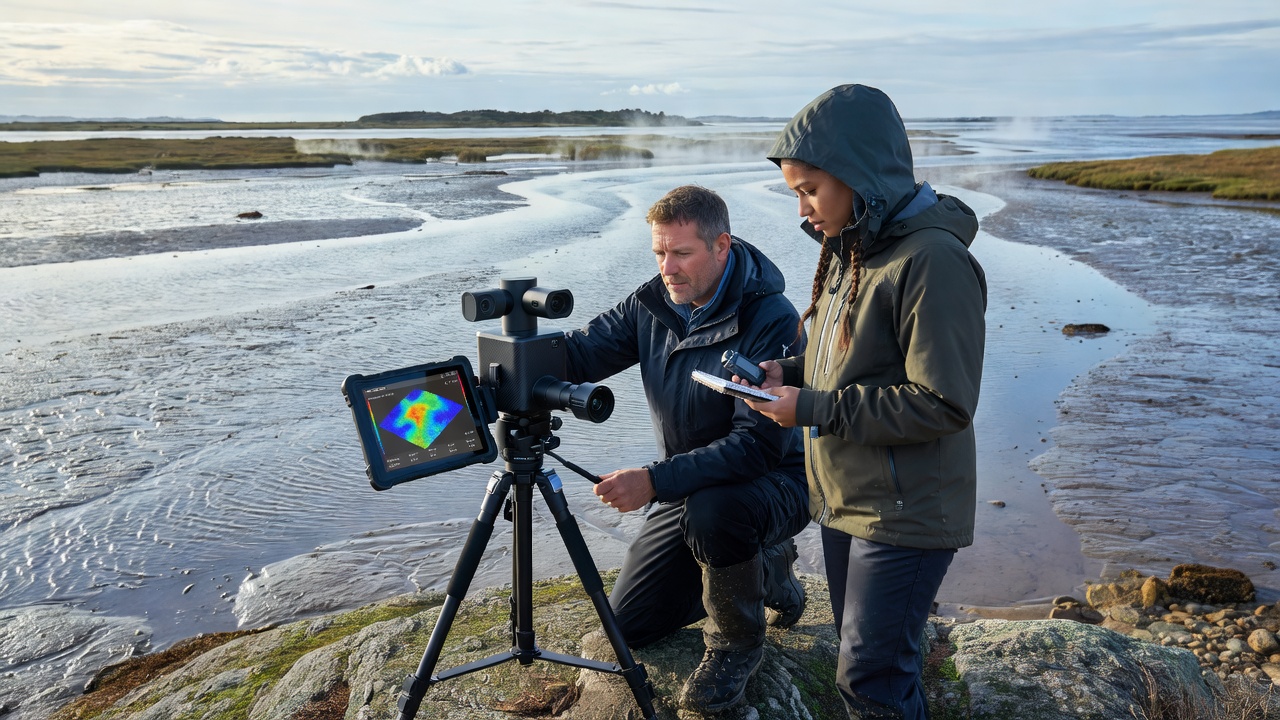
Remote estuaries present unique challenges for monitoring sediment dynamics because access often requires specialized equipment and data collection must account for tidal cycles along with variable weather patterns. Tailored imaging gear addresses these constraints by combining multispectral sensors, drone platforms, and underwater cameras that operate across different light conditions and water depths. Researchers have developed systems that capture both surface reflectance and subsurface particle movement in single deployments, which allows for repeated surveys without permanent installations.
Core Components of Tailored Imaging Systems
Equipment designed for estuary work typically includes cameras calibrated for suspended sediment concentration measurements, with filters that isolate specific wavelengths known to correlate with particle size and density. Lightweight drones carry these sensors over intertidal zones while autonomous underwater vehicles handle deeper channels, and both platforms sync data through shared timestamps. In October 2026 several field teams plan coordinated campaigns that will test next-generation hyperspectral units capable of distinguishing organic from mineral fractions in real time. Such coordination builds on earlier trials where single-platform approaches left gaps in coverage during rapid tidal shifts.
Power management remains critical because remote sites lack reliable electricity, so engineers incorporate solar arrays and high-capacity batteries that support continuous operation for several days. Data transmission relies on satellite links when cellular coverage drops out, yet onboard storage buffers recordings until retrieval becomes feasible. Calibration routines run automatically at the start of each session to compensate for biofouling on lenses and changes in ambient light that occur between dawn and dusk surveys.
Mapping Techniques and Data Processing
Teams convert raw imagery into sediment flux maps through algorithms that correct for water column attenuation and surface glare, then compare sequential surveys to quantify net transport directions and volumes. Geographic information systems overlay these outputs with bathymetric models so that erosion hotspots become visible against broader estuary morphology. Studies conducted along the Pacific Northwest coast have shown that weekly imaging intervals detect shifts missed by traditional grab sampling methods, particularly after storm events that redistribute material across wide areas.
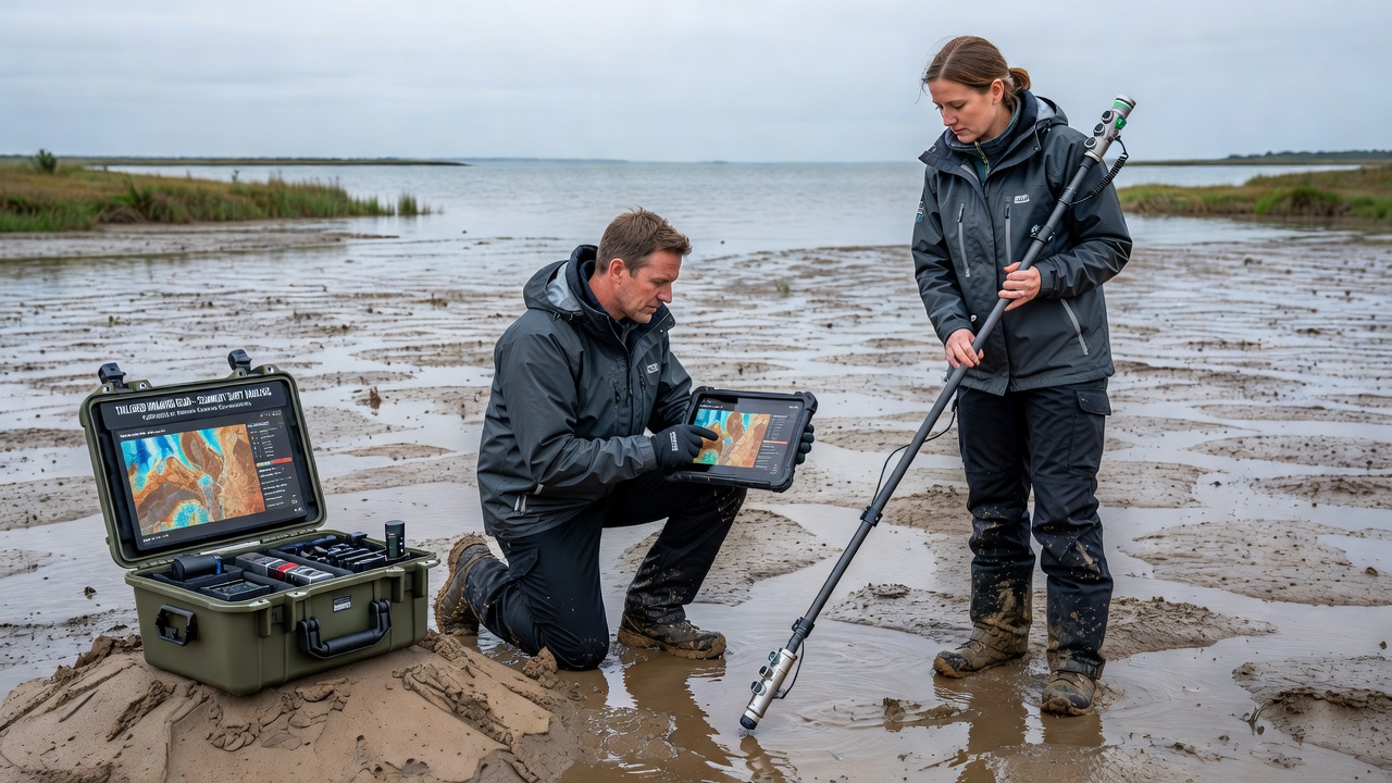
Integration with acoustic Doppler current profilers adds velocity vectors that help distinguish between resuspension events and incoming riverine loads. Observers note that combining optical and acoustic datasets reduces uncertainty in total sediment budgets, especially in systems where fine particles remain suspended for extended periods. Software pipelines now run on edge computing modules attached to field vehicles, which shortens the time between collection and preliminary analysis from days to hours.
Applications in Different Geographic Regions
Programs in North America, Australia, and northern Europe demonstrate how tailored gear adapts to local conditions. Along the Gulf of Mexico, researchers track sediment movement influenced by hurricane activity using rapid-response drone fleets equipped with stabilized gimbals. In contrast, Australian teams operating in macrotidal systems focus on long-duration moorings that capture spring-neap cycle effects on bedload transport. Data from these efforts feed into regional models maintained by agencies such as the National Oceanic and Atmospheric Administration, which incorporate imagery-derived inputs to refine predictions of habitat change.
European projects have emphasized cross-border standardization so that imagery collected in the Wadden Sea can be compared directly with datasets from the Baltic coast. Calibration protocols developed through collaborative workshops ensure sensor responses remain consistent despite differences in water chemistry and typical turbidity ranges. These shared frameworks have supported joint publications that synthesize findings across multiple estuaries, revealing common patterns in how engineered structures alter natural sediment pathways.
Challenges and Ongoing Developments
Cloud cover, strong winds, and biofouling continue to limit data completeness in some seasons, yet adaptive mission planning software now reroutes drones around predicted weather systems. Maintenance schedules incorporate lessons from previous deployments where salt spray degraded connectors, prompting the use of sealed enclosures rated for prolonged marine exposure. Cost remains a consideration for smaller research groups, although modular designs allow incremental upgrades rather than full system replacements when new sensor technology emerges.
Training programs run by universities and government laboratories prepare technicians to operate the equipment safely in remote settings, with emphasis on rapid troubleshooting during field campaigns. As imaging resolution improves and processing algorithms incorporate machine learning for particle classification, the volume of usable data continues to grow. Teams anticipate that October 2026 deployments will generate the largest synchronized dataset yet assembled for several key estuaries, providing benchmarks against which future changes can be measured.
Conclusion
Charting sediment shifts in remote estuaries now depends on purpose-built imaging systems that deliver consistent, high-resolution information under demanding field conditions. Coordinated efforts across regions demonstrate the value of standardized methods and shared data resources, while ongoing hardware refinements address persistent logistical hurdles. The result is an expanding record of estuary dynamics that supports both scientific understanding and practical management decisions.